SAN ANTONIO, United States — August 11, 2026 — Pape-Dawson announced the launch of an urban surveying services initiative focused on supporting safer community development through the integration of modern spatial measurement techniques into planning, design, and construction processes.
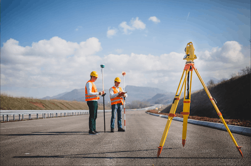
Rapid urban expansion presents tangible challenges for infrastructure, public safety, and long-term resilience. The new initiative positions surveying services as an early-stage risk-reduction and information-gathering discipline intended to inform municipal decisions, developer plans, and contractor workflows before ground is disturbed. The initiative emphasizes precise spatial data collection, verification of property boundaries, and detailed analysis of site topography to reduce the potential for costly construction delays, utility conflicts, and environmental hazards associated with new residential, commercial, and public infrastructure projects.
Modern surveying services deployed through the initiative include high-resolution topographic mapping and elevation modeling to identify flood plains and to support elevation certificates and drainage planning. These services aim to support developers and municipal engineers in assessing water run-off and stormwater management requirements for new projects. By providing elevation data tied to project plans, the surveying services seek to clarify site constraints related to flooding and water flow patterns that can affect site design and long-term performance of roads, housing complexes, and commercial structures.
The initiative also advances underground utility detection through three-dimensional mapping techniques and geophysical methods intended to reduce the risk of accidental contact with subsurface infrastructure during excavation. Detecting the location of high-voltage lines, gas pipelines, and other buried utilities prior to construction is a core component of the offering, matching the input needs of contractors and public works departments that must coordinate excavation activities with public safety imperatives. Detailed subsurface mapping conducted as part of the surveying services is described as a means to minimize construction interruptions and to inform safe sequencing of site work.
Soil and slope assessment services are central to the initiative. Field-based measurements of grade and elevation combined with site-specific analysis enable identification of unstable building sites and areas prone to erosion. These measurements support decision-making about foundation design, grading plans, and erosion control measures that impact the long-term safety and viability of developments. The surveying services include reports and spatial datasets intended to inform site stabilization approaches and to document pre-construction conditions for project records.
Boundary and title survey services are included to support accurate property delineation and easement identification. These services aim to reduce the incidence of post-construction disputes over encroachments and to provide clarity for permitting and zoning reviews. Accurate boundary information supports municipal planning and private development by ensuring design and construction occur within recorded limits and by clarifying obligations related to access, setbacks, and utility corridors.
Integration with municipal planning processes forms another pillar of the initiative. The surveying services are described as contributing geospatial datasets that can be incorporated into zoning reviews, stormwater planning, and corridor studies so that local authorities can better anticipate where aging infrastructure or environmental weaknesses may create bottlenecks as growth continues. The initiative highlights the role of verified spatial data in supporting adaptive capacity among municipalities, enabling coordination across departments from initial consultations through final as-built verifications.
The initiative outlines a staged approach to site work that pairs surveying services with project milestones: pre-design surveys to inform siting and grading, utility reconnaissance to support safe excavation, construction staking to guide contractors, and as-built surveys to document completed infrastructure. This approach is intended to reduce unnecessary excavation cycles and to limit community disruptions such as excess noise and rework by providing clear spatial references for design and construction teams.
Pape-Dawson notes that the initiative is responsive to the needs of rapidly evolving urban environments, with examples drawn from metropolitan areas where growth pressures can overwhelm older storm networks, road grids, and public utility corridors. The surveying services are framed as a technical foundation that supports municipal officials, developers, and contractors seeking to reconcile development objectives with public safety considerations and environmental stewardship during project delivery.
By emphasizing precision spatial data, documented boundary information, and coordinated subsurface mapping, the initiative seeks to align surveying practices with broader goals of resilient community development. The initiative is positioned to support projects across a range of scales, from neighborhood residential developments to larger public infrastructure investments, by providing data-driven inputs for planning and construction that are intended to reduce risk and clarify regulatory compliance requirements.
About Pape-Dawson
Pape-Dawson is a San Antonio–based firm that provides surveying services and related engineering support for public and private sector projects. The company supplies spatial data, boundary surveys, topographic mapping, and construction verification services to inform planning, design, and delivery of infrastructure and development projects.
MEDIA DETAILS
Contact Person: Media Relations
Company Name: Pape-Dawson
Email: info@pape-dawson.com
Website: https://www.pape-dawson.com/